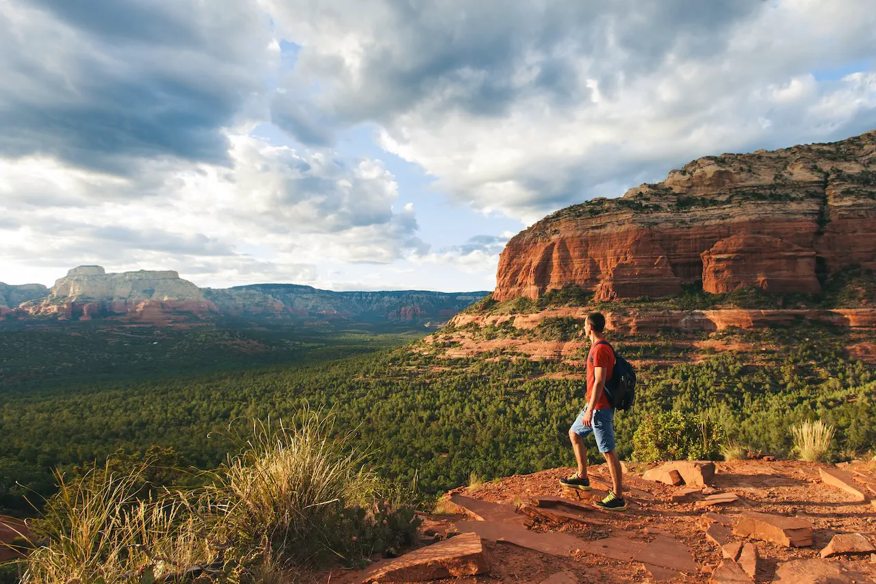
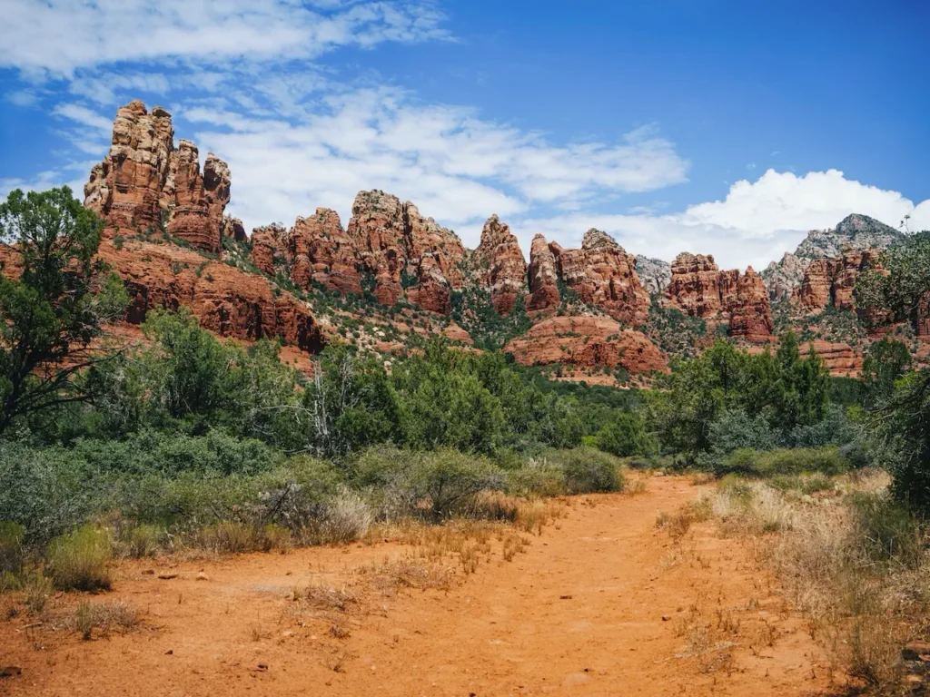
Just an hour south of Flagstaff, Sedona is nestled in the center of beautiful red rock country in Arizona. With towering red sandstone cliffs and lush greenery spread throughout the area, this place is truly magical. Hikers, photographers and nature lovers flock to this spot every season.
With over 300 miles of trails, we’ve paired it down to seven easy hikes that most people can do. Here you will find not only shorter hikes, but trails with little to no elevation gain.
Table of Contents
Bell Rock Trail
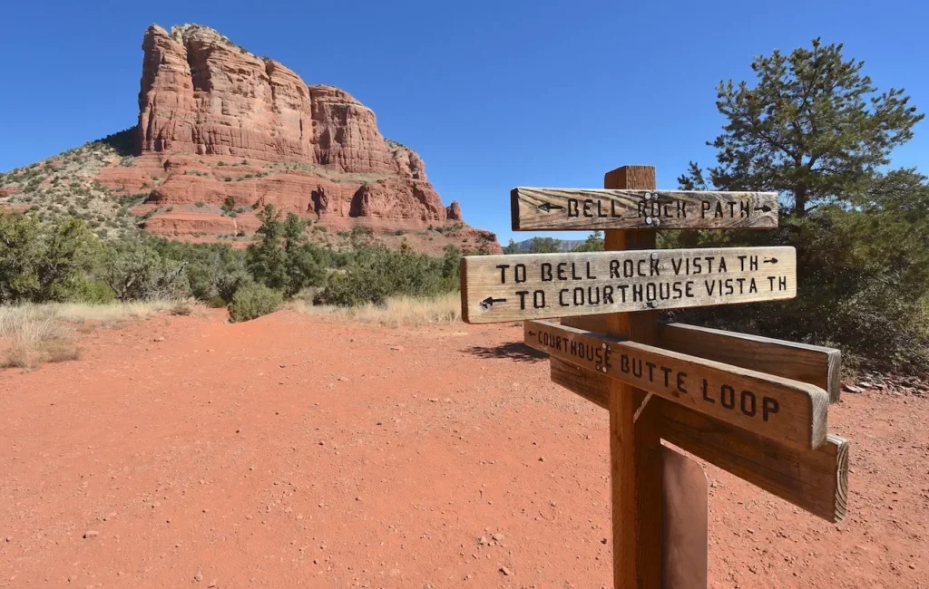
This is a well-maintained, relatively flat trail and it’s clearly marked as it leaves the Bell Rock Pathway. You will have breathtaking views along the entire trail. Along the way, you will see Baby Bell Rock, Chapel of the Holy Cross and Courthouse Butte. This area is known for having a strong vortex, as evidenced by many twisted trees along the path. There is incredible energy here and if you only have time in Sedona for one hike, this is the one to take! Note that the easy rating for this trail is for the main trail itself. There are multiple places to go off to climb some of the rocks to ascend to the top. Climbing up the rocks can be quite strenuous, and experience is needed.
Distance: 1.5 miles round trip
Elevation Gain: 318 feet
Route Type: Out and Back
Where to Park: Courthouse Vista parking lot
Baby Bell Rock Trail
This is a hidden gem in Sedona. This trail is only a mile out and back and doesn’t have much of an elevation change. What’s amazing about it is that it offers completely different views of Sedona than Bell Rock. Along the way you will be surrounded by Bell Rock, Courthouse Butte and Cathedral Rock. This is a fantastic place to hike around sunset, as it isn’t very crowded like Bell Rock.
Distance: 1.1 miles round trip
Elevation Gain: 150 feet
Route Type: Out and Back
Where to Park: Courthouse Vista parking lot
Fay Canyon Trail
Fay Canyon is a favorite in Sedona for families with kids. It’s a short, flat hike with powdery sand, surrounded by red cliffs, pinnacles and sweeping vistas. The floor of the canyon is peppered with beautiful desert wildflowers, cacti, yucca and juniper trees. Partly shaded, it is a great choice for summer months. Just over a half of a mile in, to the right, you will see a large natural stone arch that is completely viewable from the trail, so no scrambling needed. This trail also features seasonal streams.
Distance: 2.2 miles round trip
Elevation Gain: 150 feet
Route Type: Out and Back
Where to Park: Parking area on Boynton Pass Road. Trailhead is across the road from the parking area.
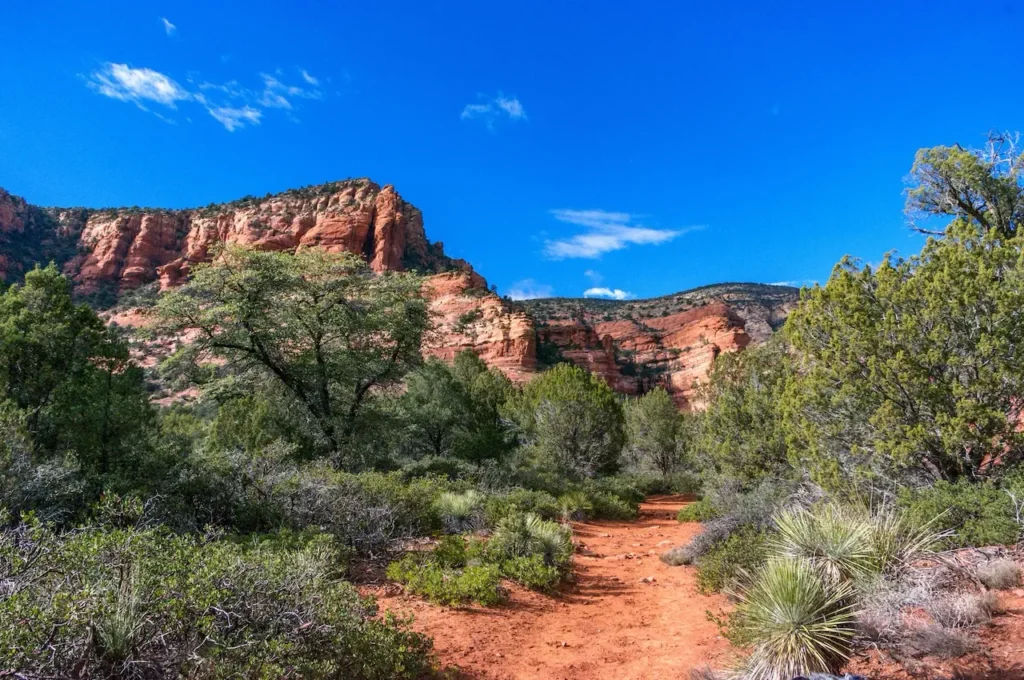
Boynton Canyon Vista Trail (Boynton Vortex Trail)
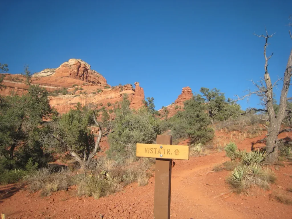
This is a popular trail because it leads to the most prominent electromagnetic vortices’ sites in Sedona. The hike starts on the Boynton Canyon Trail and in just under a half of mile in, you will come to a side trail on the right that goes on to the vista/vortex. This vista trail leads to a dead end of soaring sandstone formations, which is the vortex site. You will see plenty of twisted trees along the path. Many people come to this area to meditate and practice yoga. Often times people will bring Tibetan singing bowls with them. You may even catch a man playing a flute there, that makes the ambiance of this place even more enchanted!
Distance: 1.2 miles round trip
Elevation Gain: 134 feet
Route Type: Out and Back
Where to Park: Parking lot is at Boynton Canyon Trail.
Seven Scared Pools via Soldier Pass Trail
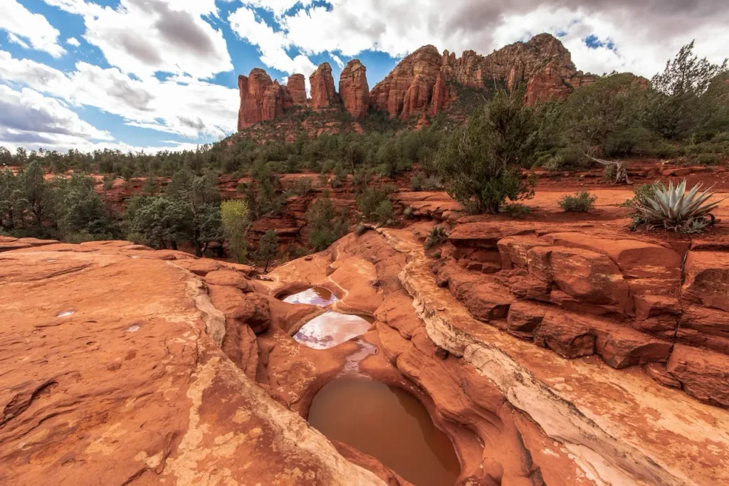
Starting at the Soldier Pass Trailhead, this short hike will showcase two natural wonders – Devil’s Kitchen (a large sink hole) and the Seven Sacred Pools. About ¼ of a mile in you will see the sinkhole. The size increases over time and is now currently 150 feet wide and 50 feet deep. Next up are the Seven Sacred Pools. These small, shallow ponds were carved over time into the in the vibrant red, sandstone canyons. In the months of May and June these pools may be completely dry. These pools are fed by a seasonal stream, so in the rainy season you may even see these pools cascade into one another – kind of like a waterfall. Along the way you will see contrasting lush green juniper, desert wildflowers and even some tadpoles in the pools. Note that the distance for this trail is from Soldier Pass Trailhead to the Seven Sacred Pools only. Soldier Pass is much longer in its entirety, about 4 miles.
Distance: 1.1 miles round trip
Elevation Gain: 108 feet
Route Type: Out and Back
Where to Park: in the main Soldier Pass Trailhead. Note that this is a small parking lot and in a residential area. Please don’t park on the neighboring road Rim Shadows Drive. You may be towed.
Sugarloaf Loop Trail
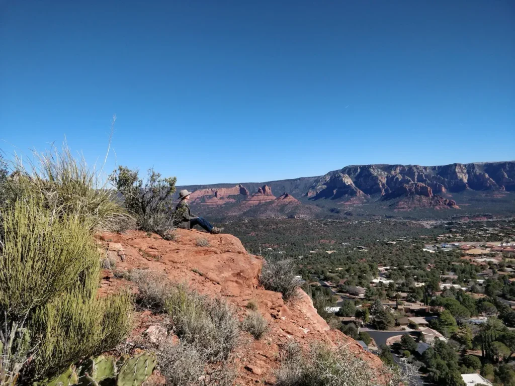
This trail offers some of the most expansive views of Sedona with minimal exertion. Red rocks surround you with lush greenery along the trail, including vibrant prickly pear cacti. You may see javelinas, rabbits, quail and coyotes along the way. As an added bonus, it isn’t often crowded, so if you are looking for a peaceful hike away from people, this is your place! This loop is combined with part of Teacup Trail and is easier when hiked counterclockwise.
Distance: 1.9 miles round trip
Elevation Gain: 354 feet
Route Type: Loop
Where to Park: off Buena Vista Drive
Palatki Heritage Site
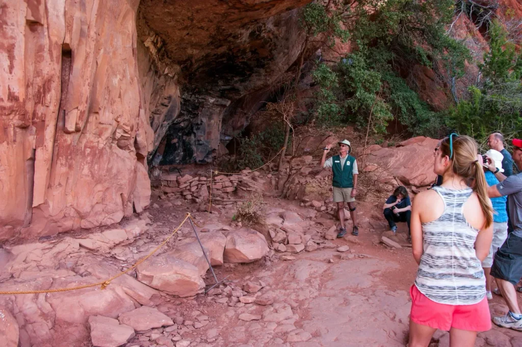
This site offers three options for super short hikes, education about this area’s rich history and features beautiful red rock views. One trail will take you right to the Sinagua cliff dwellings, one to a view of the dwellings and the last to pictographs and petroglyphs. Visiting this place is like turning back time, learning how Native Americans lived and used the area back around 1200-1300 A.D. They do limit visitors around the cliff dwellings area, so reservations are required. Admission and tours are free.
Distance: There are three separate trails, each a half a mile in distance round trip.
Elevation Gain: Minimal
Route Type: Out and Back
Where to Park: Forest Road #795
Honanki Heritage Site
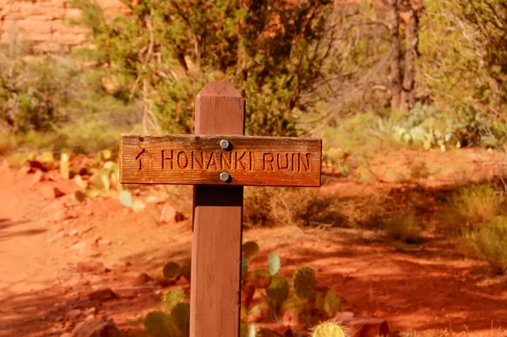
Like the Palatki Heritage Site, Honanki offers not only a short hike, but an opportunity to visit one of the largest ancient population sites in the Verde Valley. At one time there were 60 rooms in these cave dwellings. This area was occupied a little earlier and later than Palatki, but some of pictographs in the caves were present before they were inhabited, dating back as far as 2000 B.C.
Distance: 1.2 miles round trip
Elevation Gain: Minimal
Route Type: Out and Back
Where to Park: 11750 N Loy Butte Road
Tips to Enjoy these Easy and Short Hikes in Sedona
Here are some tips for hiking while in Sedona:
- Plan ahead before you venture out. Know what the weather will be and how hot or cold it will be will outside. Also pay attention to any storms that might be coming through.
- Remember that Sedona sits at 4,350 feet, which you may feel if you aren’t used to higher elevations. Effects from exerting yourself in higher elevations can be felt stronger than at sea level, so keep that in mind if you are sensitive to altitude changes.
- Many of these parking areas have a fee of $5 per car. If you have a Red Rock Pass or an America the Beautiful Pass, it will cover the parking fee.
- Parking lots can fill up quickly, especially on weekends. Plan to arrive earlier in the day.
- Bring a map with you. Cell service can be very spotty to nonexistent. Downloading a map beforehand or bringing a print version is helpful.
- If you plan on doing photography, research lighting and shadows for each trail you plan to hike. It stinks to have the perfect shot in mind, only to get there and the way the sun hits the shot ruins the shot. There are apps like PhotoPills that helps you plan the perfect shot by location.
- Bring plenty of water with you and wear sunblock. We never recommend hiking alone, but if you choose to, let someone know where you will be hiking.
Frequently Asked Questions about Easy and Short Hikes in Sedona
What is the shortest hike to the vortex in Sedona?
Rachel’s Knoll is a lesser-known but powerful vortex site in Sedona that offers a unique spiritual experience. This is the flattest & shortest walk to experience a Sedona Vortex. It has some amazing views and is the easiest hike to get to a vortex.
What is the easiest cave hike in Sedona
The Birthing Cave is a popular hiking destination in Sedona, known for its unique cave formation and stunning views. At just under 2 miles round trip, it’s one of the shorter and more manageable cave hikes in Sedona. This is still considered moderately difficult. The final ascent to the cave involves some scrambling over rocks, which can be challenging for some hikers.
How can I spend a few hours in Sedona?
In our experience, if you come in the high season, you’ll spend a few hours just getting from Oak Creek Canyon to West Sedona or Oak Creak Village. Traffic can be really bad. If you plan ahead, you can drive the Red Rock Scenic Byway, visit Tlaquepaque Arts and Crafts Village, grab a bite at Dellepiane, and see the Chapel of the Holy Cross.
What’s a good hiking itinerary for 1 day in Sedona?
Start early with Bell Rock and Baby Bell Rock. If they are open, coffee from FreeForm Coffee Roasters makes the hike that much better. Then grab some brunch/lunch. Our post on Sedona Eats will give you some options near the Village of Oak Creek. Then head to the Soldier Pass trailhead to go out to the Seven Sacred Pools. When you wrap up take a drive to Red Rock State Park and see if you can spot some Javelinas. Then head up to Airport Mesa for Sunset. Grab dinner at Mariposa and then get some rest. You’ll have earned it.
Let us know what you think about 8 Easy and Short Hikes in Sedona
Drop us a line here
Or leave us a comment below.